16258 ANDY HILL ROAD
The main headquarters.
3 bedrooms · 2 bathrooms · Office
Approximately 1,856 square feet, with barns, a shop, hay storage and garages grouped at the headquarters.
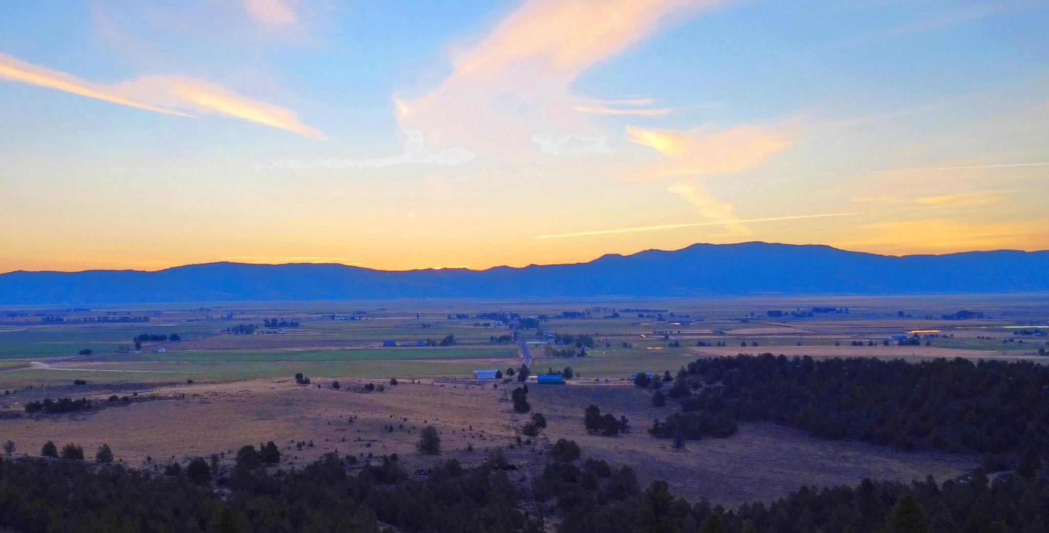
MASAMI RANCH · LAKEVIEW, OREGON
Meadow, pasture pivots and hay ground in Oregon’s Goose Lake Valley.
A working cattle ranch near Lakeview, Oregon.
Presented by High Country Real Estate
and eXp Realty
THE PLACE & THE POSSIBILITY
1,325.56± deeded acres bring meadow, irrigated pasture, hay ground and two headquarters together in Oregon cattle country.
The supplied field plan identifies pasture pivots, meadow grass, alfalfa, annual mixtures and triticale. Explore how those pieces fit a year of grazing and winter feeding, then look closely at the water records and working improvements.
Read the full property brochure PDF · 14 pages · 16 MBFROM THE DRONE
Watch the ranch film, then explore
individual views from the drone.
Explore the fields, center pivot and Andy Hill headquarters.
Fields & the valley · An eight-second aerial view of the fields around the ranch headquarters.
Choose a view, then press play. Original property footage, without narration or advertising overlays.
Open selected clip ↗CATTLE & HAY
Grazing through the growing season.
Hay feeding through winter.
Year-round capacity includes winter hay feeding.
REPORTED HAY PRODUCTION
Approximately a 50/50 mix
of grain hay and alfalfa.
Capacity, grazing dates and production are based on the lessee’s records and statements and have not been independently verified. Reported hay production is not represented as surplus available for sale in addition to feeding the stated herd. Buyers should verify operating records and carrying capacity.
EXPLORE THE GROUND
Pasture pivots. Meadow. Harvested forage.
Choose a field to see its part in the plan.
The map shows the supplied seller field plan. P1 and P2 are grass pasture under pivots; P3 is meadow pasture. Alfalfa, annual mixtures and triticale add harvested-forage ground alongside the grazing base.
The relationship is the point: growing grass for cattle to harvest and producing forage that can be carried into winter. Current crops, rotations and field-level water assignments require buyer verification.
Grass pasture across the two northern pivots and the southern meadow.
Harvested-forage fields at the half-pivot and south pivot.
Annual forage areas on the eastern side of the plan.
The southern strip is identified as triticale, a cereal forage.
These are the supplied certificate and survey-map documents. They support review of the water-right schedule; no field assignment is established by linking them here.
Field uses: supplied seller field plan; crops and rotations may change. Imagery: Esri / Vantor. Tax-lot outlines: Lake County GIS. Water overview: supplied OWRD-derived illustration referencing 98910, 63272 and 74204. Groundwater shading follows pivot footprints, not legal water-right boundaries. The creek/slough rights are not delineated. Outlines are approximate and are not a survey or verified irrigated acreage. Overlapping water layers are not additional acres.
HOMES & WORKING IMPROVEMENTS
Homes, equipment space, hay storage
and facilities for the daily work.
16258 ANDY HILL ROAD
3 bedrooms · 2 bathrooms · Office
Approximately 1,856 square feet, with barns, a shop, hay storage and garages grouped at the headquarters.
14188 WESTSIDE ROAD
3 bedrooms · 2 bathrooms
A residence with a shop, hay barn, covered corral and pump house on the Westside Road portion.
Areas and improvements are approximate, from the supplied inventory and assessor records. Buyer to verify dimensions, condition and what is included in the sale.
WATER & THE GROUND IT SERVES
The property records identify Lakeview Water Users surface water, Drews Creek and slough rights, groundwater primary rights and supplemental rights. Each has a different place in the schedule.
THE GOOSE LAKE VALLEY SETTING
Goose Lake Valley occupies a largely closed basin. Its agricultural landscape draws on mountain runoff, streams, reservoir storage and groundwater. Lakeview Water Users relies predominantly on Drews and Cottonwood reservoirs for summer supply.
This is the regional setting for the ranch’s water records. Seasonal availability, authorized uses and field coverage must be evaluated from the underlying rights and delivery records.
The 2026 invoice documents 426.80 assessed acres. The ranch’s reported share is included once in the primary-right schedule; the assessment is not a separate additional water right.
Drews Creek and slough rights are listed separately from Lakeview Water Users water in the supplied certificate schedule.
Groundwater certificates are part of the ranch’s records. Certificate 74204 has an unresolved difference between original-certificate acreage and the WRIS summary.
Kept separate from primary rights. Supplemental acreage may overlap primary acreage and must not be added as additional irrigated ground.
| Certificate / source | Primary acres | Supplemental acres |
|---|---|---|
| 98910 · Lakeview Water UsersSaved PDF copy | 426.80 assessed¹ | — |
| 50602 · SloughSaved PDF copy | 30.00 | — |
| 68660 · Drews CreekSaved PDF copy | 62.72 | — |
| 74206 · SloughSaved PDF copy | 23.60 | — |
| 63272 · GroundwaterSaved PDF copy | 157.40 | 63.60 |
| 74204 · Groundwater*Saved PDF copy | 163.50* | 99.10* |
| 94826 · GroundwaterSaved PDF copy | 83.90 | 96.40 |
| 79086 · GroundwaterSaved PDF copy | — | 25.30 |
¹ The assessed acreage is the ranch’s reported share under the LWU certificate, not the full acreage of Certificate 98910. Superseded Certificates 94966 and 76813 are not counted. *Original Certificate 74204 lists 163.50 primary and 99.10 supplemental acres; the WRIS summary shows 62.10 and 17.20. This discrepancy remains unresolved. Certificate 94826/map range references also require reconciliation. The brochure contains the full schedule and qualifications.
BUYER DUE DILIGENCE
All water rights must be independently verified, including current status, acreage, priority, authorized use, place of use, overlap, transfers and water availability. Scheduled rights acreage is not verified net irrigated acreage or a guarantee of delivery.
MEADOW, FIELDS & FACILITIES
GROUNDWATER RECORDS
Two irrigation wells and two domestic wells.
Each record matches an included ranch parcel.
WELL LOG · LAKE 2745
Water-right proof-map location; matches the northern pump area.
Open original well log OWRD record ↗WELL LOG · LAKE 2809
State-mapped location near the southern pump area. See the location note below.
Open original well log OWRD record ↗WELL LOG · LAKE 2746
Approximate quarter-section location on the Andy Hill headquarters parcel.
Open original well log OWRD record ↗WELL LOG · LAKE 50520
The log identifies tax lot 5500, matching the Westside headquarters parcel.
Open original well log OWRD record ↗Location review. Parcel matches are based on OWRD well locations, the county GIS parcel layer and the supplied ranch boundary. LAKE 2745 has a location derived from a water-right final-proof map; the other three state locations are approximate quarter-section locations, not surveyed or GPS-verified well positions.
LAKE 2809 location discrepancy. The handwritten log lists NW¼ SW¼; the state index lists SW¼ NW¼. Both indicated areas match ranch account 15587. Reconcile the descriptions with the physical well during buyer due diligence.
Buyer verification. These are historical construction records. Confirm physical well locations, current condition, yield, water quality, authorized use and water-right connections. Recorded depth does not establish current pumping performance or a separate water right.
Review the water-right certificate schedule ↑THE PROPERTY PACKAGE
Keep the offering and its source documents
close at hand as you investigate the ranch.
Photographs, improvements, operating information, maps and water-right schedule.
Open brochure ↗02 · FIELD PLANView the supplied plan for the pasture pivots, meadow, alfalfa and annual forage.
Open crop map ↗03 · WATER RIGHTSPrimary and supplemental rights shown separately, with source PDFs and verification notes.
Review water records ↑04 · WELL RECORDSTwo irrigation and two domestic construction records, with parcel-match notes.
Review well logs ↑Want to look at the land and the records together?
Arrange a ranch visitCOME SEE MASAMI
Call or email Rich or Colby to arrange a showing, ask a property question or request additional records. Visits are by appointment; please respect the ranch’s existing tenancy.
HIGH COUNTRY REAL ESTATE
Oregon Principal Broker
541-417-0250rich@highcountryrealestate.comRequest the property packageeXp REALTY
Oregon Principal Broker · Accredited Land Consultant
541-589-2247colby.marshall@exprealty.comAsk about a showingMasami Ranch · Lakeview, Oregon
1,325.56± deeded acres · Offered at $4,950,000